New tools for increasing Urban Resilience in Europe
Copernicus for Urban Resilience in Europe (CURE) project leverages on Copernicus and local data to offer an online system with 11 integrated applications to support sustainable and resilient urban planning and development.
Background
Spatially disaggregated environmental information, at neighbourhood and city scales, is not directly available from the Copernicus Core Services. This limits the use of these data, and thus a more accurate focus on resilience aspects, in urban planning. However, several data and products from satellite missions represent valuable tools for retrieving that information.
The CURE system was designed to address the multidimensionality of urban resilience offering urban environmental parameters at the required scale for urban applications, through the combined exploitation of Copernicus Core Services, Sentinel and third-party data.
What is it
The CURE system offers 11 individual cross-cutting Applications deployed in DIAS (Data and Information Access Services) to support understanding, analysis and action at urban level, representing valuable tools for climate change adaptation/mitigation action, energy and economy, as well as healthy cities and social environments, in several European cities ((Berlin, Copenhagen, Sofia, Heraklion, Bristol, Ostrava, Basel, Munich, San Sebastian, Vitoria-Gasteiz).
The current existing applications are:
“The CURE System provides reliable, up-to-date and area-wide information of the city of Heraklion, important to inform decision-making and guide urban policy making and implementation towards resilience building.” Renia Drosou, Head of the Directorate of Planning, Programming and ICT, Municipality of Heraklion
- Local Scale Surface Temperature Dynamics Application
- Surface Urban Heat Island Assessment Application
- Urban Heat Emissions Monitoring Application
- Urban CO2 Emissions Monitoring Application
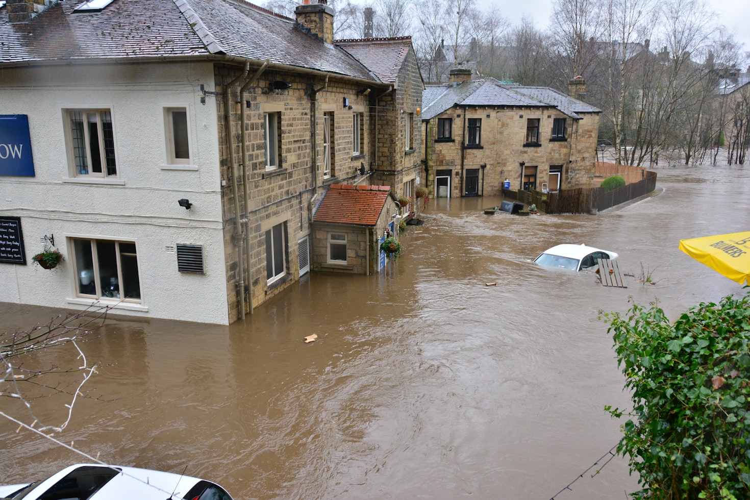
- Urban Flood Risk Application
- Urban Subsidence, Movements and Deformation Risk Application
- Urban Air Quality Application
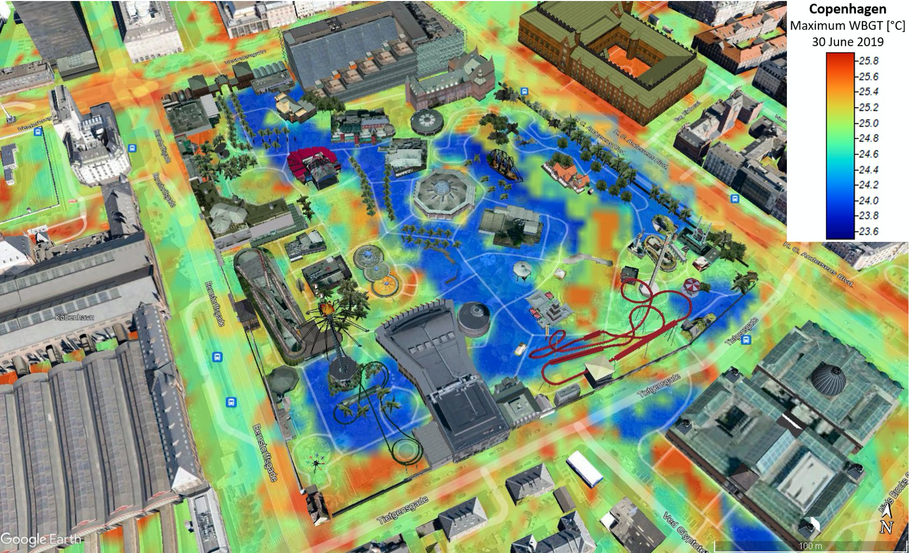
- Urban Thermal Comfort Application
- Urban Heat Storage Monitoring Application
- Nature-Based Solutions Application
- Health Impacts Application
How it works
The CURE System uses information concerning atmosphere, land, climate change and emergency from Copernicus Core Services (CLMS, CAMS, C3S and EMS) in a cross-cutting way, and integrates it with spatially disaggregated Earth Observation (EO) data and third-party products (e.g. data from contemporary satellite missions, in-situ measurements, health profiles, energy consumption, traffic and population data, etc.), which are also used to evaluate and benchmark the different approaches and to downscale Copernicus-derived city scale atmospheric parameters.
The overall CURE approach is based on a continuous interaction process with the users (Copernicus developers and urban planning communities) to gather their requirements as well as to demonstrate and evaluate the CURE system and its applications.
“The combined use of Copernicus Core Services in the CURE System encourages further synergies among the European academic and industrial actors in future applications, stimulating the wide exploitation of Copernicus products in downstream services in the emerging market of urban resilience.” Natassa Antoniou, Market Development, EARSC - European Association of Remote Sensing Companies
Key features
Exploiting Copernicus
Data and products from different Copernicus Core Services and satellites are used as main input data, providing the potential to implement the CURE System to more cities.
Developing a cloud-based platform
The CURE System deploys the cloud technology to combine data and products from multiple sources and serve the different needs of its users (i.e. urban planners or downstream application developers).
Addressing urban resilience challenges
The 11 CURE cross-cutting Applications can address a variety of urban resilience challenges providing spatially disaggregated products at the required local scale for 10 European cities.
Benefits of WEkEO for Copernicus for Urban Resilience in Europe (CURE) system
WEkEO is ideal for the distributed processing of the CURE System, as it provides various Copernicus data and customizable virtual processing environments, along with:
- Cost plan tailored to user needs
- Service maturity and stability
- Fast support
Contact us to know more about Copernicus for Urban Resilience in Europe (CURE) system.