The EEA about to join WEkEO - the Copernicus DIAS specialised in environmental data right from the source
As of 2020, the European Environment Agency (EEA), which implements the local and Pan-European components of the Copernicus Land Monitoring Service (CLMS), started using WEkEO as an implementation environment, and is preparing to join WEkEO as a partner.
WEkEO is the Copernicus Data and Information Access Services proposing environmental data, virtual environments for data processing and expert user support.
The EEA is preparing the path to join the existing implementing partners EUMETSAT, ECMWF (Copernicus Climate Change Monitoring and Atmosphere Monitoring Services) and Mercator Ocean (Copernicus Marine Service). As such, WEkEO will bring together the institutions behind four of the six Copernicus Services, as well as the institution responsible for operating the Copernicus Sentinel-3 and Sentinel-6 satellites (and Sentinel-4 and Sentinel-5 in the near future) - EUMETSAT.
With the addition of the EEA, WEkEO users can now benefit from data and expert user support directly from the four Copernicus Services focused on environmental monitoring, as well as from EUMETSAT experts.
Hans Dufourmont CLMS Project Manager at the EEA, stated:
“Working with WEkEO quickly became an obvious choice for the EEA: WEkEO enables us to facilitate cross-service cooperation in a broad environment as well as in a climate change domain”
He continued:
“It’s also a cooperation that the EC has underlined in the recently approved EU space programme regulation. In addition, the distributed architecture of the WEkEO DIAS, right from the outset, perfectly fits the way the EEA cooperates with the Member States in its Eionet network. There is substantial added value in bringing all environment and climate related Copernicus services together, for which WEkEO can definitely be seen as the facilitating asset.”
The EEA recently used WEkEO to generate and host one of its latest Copernicus Land products: the High Resolution Snow and Ice Monitoring product. This product provides high resolution data on fractional snow cover, persistent snow area, river and lake ice extent and aggregated river and lake ice extent for the EEA38 + UK. The four datasets are available through WEkEO here.
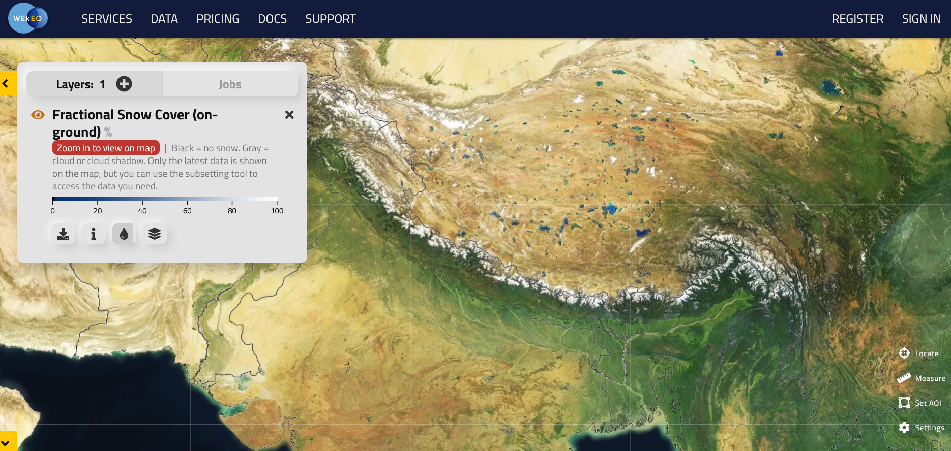 Fractional Snow Cover (on-ground) over the Himalayas. This is one of the products available within the High Resolution Snow and Ice Monitoring product provided by the Copernicus Land Service / EEA. Source: WEkEO, Earth viewer.
Aside from the Snow and Ice product, a large array of data from the Copernicus Land Monitoring Service is already available through WEkEO including data from the Global (e.g. land cover, NDVI, etc.), pan-European (e.g. CORINE Land Cover (CLC)) and local hotspot monitoring components (e.g. Urban Atlas), as well as image mosaics and reference data (e.g. EU Digital Elevation Model (EU-DEM)). The full list of available Copernicus Land datasets can be found here
The Copernicus Land Monitoring Service data joins the already available marine, climate and atmosphere data from the relevant Copernicus Services, as well as data from Copernicus Sentinel-1, Sentinel-2, Sentinel-3 and Sentinel-5P satellites. All the datasets can be explored and visualised here.
WEkEO in a nutshell
WEkEO provides environmental data directly from the source, with user support from the experts behind the data, as well as a powerful processing infrastructure and tools to develop, scale and evolve your code or application.
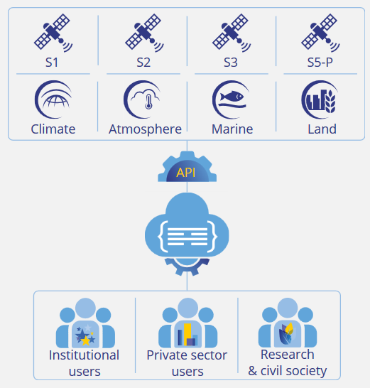
Data, infrastructure and tools
Since WEkEO is implemented by the institutions in charge of generating Copernicus data and products, the data infrastructure between those institutions and WEkEO is directly linked, rather than being duplicated. WEkEO users benefit from the most up-to-date Copernicus environmental data, rather than relying on copied and archived datasets.
This direct link to the original data source is complemented by powerful processing tools such as Jupyter Notebooks, SNAP and QGS, a distributed infrastructure connected by an ultra-high-speed backbone, and a harmonised data access API which allows uniform access to the whole WEkEO catalogue (REST-based single protocol).
Expert user support
WEkEO provides expert user support to all its users, regardless of the user’s plan. But it’s not just any user support! Because the institutions behind WEkEO are the Copernicus Services (ECMWF, Mercator Ocean international, and EEA) and EUMETSAT, WEkEO users benefit from the expertise of the entities and scientists behind the data and products.
Plans and pricing
WEkEO offers a free ‘Essential’ plan, as well as paid ‘Advanced’ plans. The Essential plan does not compromise on the quality of the experience or data available. Users have access to all datasets and can download them, as well as use Jupyter Notebooks and benefit from the aforementioned expert user support.
With the Advanced plan, users enjoy all the above as well as powerful virtual processing environments with varying storage capacity and functionalities, processing tools and free in and out networking.
All information regarding the plans and pricing can be found here.
Sound interesting? Want to know more?
Start exploring WEkEO now, keep up to date with all the latest WEkEO news through Twitter and don’t hesitate to reach out to our experts at support@wekeo.eu if you have any questions.