Harness the power of space-based data with WEkEO
Combining powerful processing tools and virtual environments with continuously updated data from the four Copernicus environmental Services and the Copernicus Sentinel satellites, WEkEO is the perfect tool to help you make the most out of Copernicus space data as well as data derived from in situ technology and models.
What benefits do space-based data offer?
Since late December 2021, the Copernicus Sentinel-1B satellite has stopped transmitting data. While most citizens are unaware of the role that space-based data play in their daily lives and the benefits they bring to society, the potential loss of Sentinel-1B and the recent eruption of the Hunga Tonga-Hunga Ha’apai volcano provide a glimpse into the importance of these data.
Sentinel-1B is a radar imaging satellite, which provides high-resolution imagery regardless of weather conditions. Together with Sentinel-1A, they provide timely data that are used for maritime and land monitoring, climate change, security and emergency management. With Sentinel-1B out of order, these stakeholders lose crucial data which they have come to rely on.
For example, in emergency situations such as the Hunga Tonga volcano eruption or the extreme flooding experienced in July 2021 in Central Europe, where cloud cover is often an issue for optical imaging satellites, emergency response authorities would now have to wait up to 12 days for Sentinel-1A to revisit in order to obtain a new snapshot of the situation, instead of up to 6 days when both Sentinel-1 satellites are orbiting.
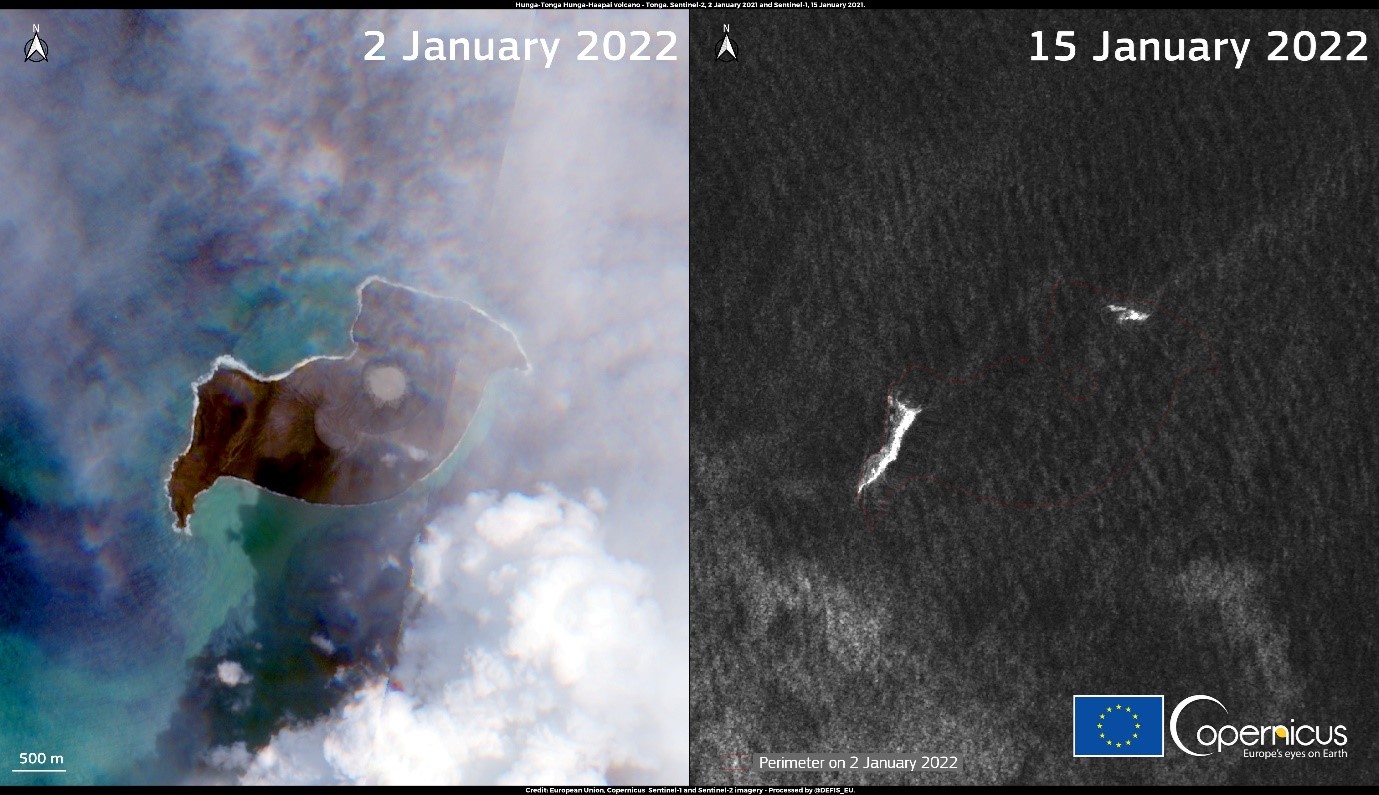
Copernicus Sentinel-2 satellite acquired on 2 January 2022 (left) and Copernicus Sentinel-1 satellite from 15 January 2022 (right) show the consequences of the Hunga Tonga eruption. Credit: European Union, Copernicus Sentinel-1, Sentinel-2 imagery
This is but one example of the importance of space-based data for our society. They directly benefit many more areas, such as agriculture, transport, climate research and biodiversity protection, energy production and water management. Space-based data also provide reliable and accurate information that can support policymakers and public authorities to make decisions and implement policies. Not only do these data provide direct benefits to many sectors, they also boost innovation and support the development of added-value solutions that can contribute to economic growth, digitalisation and sustainable development.
How can WEkEO help you take advantage of space-based data?
The WEkEO platform is an important gateway to harnessing the power of these space-based data. Not only does it provide free and open access to data from the Sentinel constellation, as well as data and products from the four Copernicus Services focused on environmental data (marine, atmosphere, climate and land), it also provides free (and paid) access to powerful virtual processing environments that allow users to transform data. Entrepreneurs, researchers or any interested citizen can use the WEkEO platform to develop an added-value application, develop models and transform data, or simply explore Copernicus space-based data and data derived from in situ technology and models.
With renewed commitment from the European Commission to the Copernicus programme and WEkEO platform, WEkEO users will continue to benefit for years to come from the most up-to-date Copernicus environmental data, thanks to a direct link between the WEkEO platform and the data infrastructure of the institutions behind the four Copernicus environmental services. Additionally, users can rely on expert user support provided by the entities and scientists behind the data and products.
Start exploring WEkEO now and keep up to date with all the latest WEkEO news through Twitter and Facebook.